The cold is finally going away and just in time for this months night race at the Casterbridge Lifestyle Center.
Join us for some fun in the dark and the chance to run through the
orchards and around the dam with nothing but the stars and your headlamp
to light the way.
Trail running in the lowveld has come on leaps and bounds over the past
two years but to encourage the continued growth and make the night run a
truly family event all Under 16's race for free.
Any questions feel free to Ash on 082 0528393
So now in its 3rd year, the Num-Num trail challenge is starting to prove itself as an incredible up and coming trail race, attracting some big names in the trail scene. And for good reason - the
route profile is one of the closest to the biggest race on the calendar, the
Otter African trail run. The Num-Num allows the runners to get an idea of how
their training has been going throughout the year and the puts it to an
incredible test. I stayed over with Landie and Christiaan Greyling at their
parents’ house together with adventure racer and trail athlete Ryno Griesel. I psyched myself up for the event by learning everything I can from them,
which didn't help much because they don't even Carbo-load! Their pre race meal consists of Lamb shank and
veggies!
The Num-Num is a 36km / 5 day trail but we run it all in
one go!
The race started early as I was seeded in
the first group. My competitive spirit is always too high at these events (I
can never hold back) so I naturally fell in behind and tailed Christiaan and
Ryno (Salomon sponsored athletes). We covered a short stretch of tar and that
was the last bit of smooth road for the rest of the race. As we hit the trail,
it started with a good climb and it just went up and up and up, eventually
climbing onto a plateau known as “Die Vlakte” at the 3km mark. This allowed one
to turn the legs at a runners pace. At this point the eventual race winner
Lucky Miya flew past me. This section is only a couple of meters long before you
descend along steep cliffs, where a wrong step can really put one in a lot of
trouble. It’s up and down from then on until you travel through the stone tunnel
and arrive at the first check point.
The first part of this section allows you
to get some running in but it is very technical, so you will only be running if
you are confident. A runner that I had just passed took a nasty fall at that
point and I could see that it destroyed his confidence as he fell back really
quickly. But all that aside, this is a really beautiful section of the trail. You
drop down to a small waterfall below and traverse along it, criss-crossing and
boulder hopping along a stunning stretch of stream before you hit a super
killer climb straight back up the mountain. Now when I say super killer, I mean
there is no way anyone could run it! Hold onto those trees and grit your teeth until
a relatively even uphill (not really) and then travel along a ravine climbing a
few ladders till you get to a dirt ROAD. Now if you’re not too battered and
bruised you get to run about 3 km of badly rutted jeep track until you hit the
single track again and experience a quad killing decent. At this point I was a
bit too brave and took my first face plant of the race after kicking a stump. Adrenaline
and momentum got be going real quick again! Once you get to the bottom you cross over an
incredibly thin suspension bridge and this indicates the start of the insane
climb up to Bermanzi Camp. This is where the gradient lines on the map form one
thick solid line…
The start of day 3 is good going. It’s a
technical decent that allows one to run while grabbing onto any branches
possible until you eventually travel along the river. At this stage you cross
bridges and climb a few ladders and the field is so stretched out that it
becomes a very lonely section of trail. The trail eventually opens up to a
stunning waterfall that I really hate. Seriously! It indicates the start of a
mean climb and the point at which my legs locked up and cramped for the first
time. Many baby steps later you finally end day 3.
If your legs are not locked up too badly day 4 is actually the one section where you can probably run the most. It has
moderate climbs, a few really steep ones, but killer descents that give your
quads moments to remember. It’s where you really have to think about how long
your knee caps could last. At this section’s halfway point you reach a stunning
section of forest where my legs locked up and cramped for a second time. This time
so badly that any movement initiated more cramping. I got going again after a
good stretching session and some super slow walking just in time for some more ladder
climbing and descents before the start of the final section – day 5.
At this point things got a little blurry…I
know you climb and climb and climb, only to descend again and climb down the
longest ladder you will ever come across. Then descend, descend, descend some
more down the canyon to the river where you can splash your face in the awesome
winter stream. Then climb, cramp, climb, cramp and climb back out the canyon. If
you are able to turn your legs over at this point you could make up some ground,
traveling along a stream criss-crossing it until out of absolutely nowhere you
see a whole bunch of faces showing no sympathy at all at the finish line.
See you on the trail!
Sven Musica
Murray (right). Image by Ilonka Potgieter
Sven (below). Image by Ilonka Potgieter
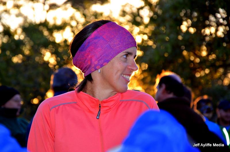
Sven (fake smile). Image by Ilonka Potgieter
Too fast for the photographer.
Andrew Dollenberg's GPS Elevation Chart
Nedbank / LVCC Results:
12th SVEN MUSICA 05:31:04
40th MURRAY ANDERSON-OGLE 06:59:31
43rd ANDREW DOLLENBERG 07:11:43 Photos by Murray Anderson-Ogle
Witklip Dam is a gravity and arch type dam located on the Sand River near Sabie, Mpumalanga, South Africa. It was established in 1969 and serves primarily for irrigation purposes.
Coordinates: 25°14′10″S 30°54′1″E Opening date: 1969 Type of dam: gravity, arch Height: 21.6 meters Length: 670 meters Impounds: Sand River Reservoir Creates: Witklip Dam Reservoir Capacity: 12,970,000 cubic meters Surface area: 178 hectares
Jen and I have just spent the most amazing time at Mt Sheba, a Forever Lodge high on the escarpment edge between Lydenburg and Pilgrim's Rest. The manager Adriaan Harper and Ilanga Trails are pleased to announce the first trail on the property, to be run on August 31 2013.
The lodge has many short trails already marked out on their enormous property which includes vast areas of natural forest riddled with streams and waterfalls. My task was to link theses shorter trails up, and boy did I have a great time. Starting out at around 1640m I followed existing trails climbing slowly up to 1920m. We have to run in the paved entrance road for a short stretch to get to the top, but I don't think you will enjoy the alternative (VERY steep). Once on the top I set off to find a path to link to the trail at the far end of the ridge. A fire break made the perfect route and I started the steep decent on the Eastern side of the property. Down a steep technical (rocky) section then zig zagging down another fire break, I linked up to a forestry road. Following this I came out about 10m from another of the marked trails. It took me about 10 minutes to penetrate the dense vegetation, cross the stream and get onto the trail. Do not fear, I will return with a team to clear a path. I was now at the lowest point on the property, 1440m. Only 200m to climb back to the lodge. I really got some great 'Otter' training in on the run.
We will be presenting 6, 12 & 18km distances with about 800m accent on the long run.
Great prizes such as a R10 000 holiday voucher for Forever Resorts Badplaas, amoungst others, Spot Prizes, and Lucky Draws. Medals to finishers in all distances!
Mt Sheba, a Forever Lodge offers four star accommodation as well as a camp ground for up to 10 tents. Management will lay on electricity for the campers over the weekend. The cuisine is outstanding, the pubs warm and inviting. Come and celebrate the last day of winter in the mountains, you won't regret it!
Book Now! Avoid disapointment!
20km limited to 150, 12km limited to 200. Click here or on the Logo
Heading off along the banks of the Mac Mac River the trail winds around enormous matumi, forest big leaf, waterberry, white stinkwood and mitzeri trees. Beware, their roots are waiting to grab that weary ankle. The route has technical sections and about 2km of very old jeep track. The trees drop their leaves year round, but more so in the winter months, hiding the rocks that abound the trail. Running under a dense leafy canopy for most of the trail, I would not recommend wearing sun glasses as they tend to hide the uneven ground. If you want to admire a sight along the way, stop and look, don't break your concentration while running, you will take a tumble.
The Matumi picnic spot is just across the bridge at the 4.3km mark. Take some time to look around while you enjoy some 32Gi energy drink before you set off back down the opposite bank for a very technical route home. Except for one sharp climb it is all down hill along the banks of the Mac Mac River. Get ready to get the feet wet, the finish lies on the opposite bank of the river and you have to cross it to get home. Remember, stick to the sand as the pock are slippery and the water is cold!
Click to enlarge
Blue Route 14.4km
Starting off, with the 20+km runners, along the quad and mountain bike tracks the trail heads West along the banks of the Sabie River. Zig-zagging and winding up and around the hills you run through 'Blue Gum' plantations, some of which are being harvested. watch out for logs and branches that may lie across your path.
Just before 5km you round a bend and a spectacular view of the Sabie River tumbling down a water fall and over massive granite boulders requires you stop for a few seconds to take it all in. You then set off to run around a ravine to meet up with the river above the falls. Gently climbing up you reach the highest point on the rout at the 8km mark. After a kilometre of undulating forest you start a sharp 400m decent to the 'Induna Cross Roads' where you will find the first water point at 9.3km. You will turn left at the water point for an 800m short cut to the bridge on the Mac Mac River.
The Matumi picnic spot is just across the bridge at the 4.3km mark. Take some time to look around while you enjoy some 32Gi energy drink before you set off back down the opposite bank for a very technical route home. Except for one sharp climb it is all down hill along the banks of the Mac Mac River. Get ready to get the feet wet, the finish lies on the opposite bank of the river and you have to cross it to get home. Remember, stick to the sand as the rocks are slippery and the water is cold!
Click to enlarge
Red Route 21.5km
Starting off, with the 14km runners, along the quad and mountain bike tracks the trail heads West along the banks of the Sabie River. Zig-zagging and winding up and around the hills you run through 'Blue Gum' plantations, some of which are being harvested. watch out for logs and branches that may lie across your path.
Just before 5km you round a bend and a spectacular view of the Sabie River tumbling down a water fall and over massive granite boulders requires you stop for a few seconds to take it all in. You then set off to run around a ravine to meet up with the river above the falls. Gently climbing up you reach the highest point on the rout at the 8km mark. After a kilometre of undulating forest you start a sharp 400m decent to the 'Induna Cross Roads' where you will find the first water point at 9.3km. You now leave the 14km runners and head back down the trail for a very fast 3.6km section.
Just before you get back to the Sabie River you head off along the banks of the Mac Mac River. The trail winds around enormous matumi, forest big leaf, waterberry, white stinkwood and mitzeri trees. Beware, their roots are waiting to grab that weary ankle. The route has technical sections and about 2km of very old jeep track. The trees drop their leaves year round, but more so in the winter months, hiding the rocks that abound the trail. Running under a dense leafy canopy for most of the trail, I would not recommend wearing sun glasses as they tend to hide the uneven ground. If you want to admire a sight along the way, stop and look, don't break your concentration while running, you will take a tumble.
The Matumi picnic spot is just across the bridge at the 17km mark. Take some time to look around while you enjoy some 32Gi energy drink before you set off back down the opposite bank for a very technical route home. Except for one sharp climb it is all down hill along the banks of the Mac Mac River. Get ready to get the feet wet, the finish lies on the opposite bank of the river and you have to cross it to get home. Remember, stick to the sand as the rocks are slippery and the water is cold!
Please Note
These routes may change slightly depending on agricultural activity or extreme weather. Ilanga Trail Series will attempt to keep all route maps and profiles up to date. We may be forced to re-route sections at the last minute and these changes will be made known at registration on the Friday and at the start on Saturday.
We thank the land owners for their generosity, without which this route would not be possible.
Here are some beautiful images of Helette, Ciska, Petro and Venessa at the Southern Cross Trail Run that took place in the Western Cape over the long weekend. Well done ladies! More images and a race report coming soon!
Our
team has been very hard at work for the last 4 months to design and
build arguably the most spectacular mountain bike and trail running
trails the Lowveld has ever seen! York Timbers, one of the biggest
landowners in the Sabie and surrounding area, will be giving you the
opportunity to become a member of the York Adventure Club, with the aim
to create a safe and controlled environment for cycling and running.
Please join us in Sabie for the weekend of 13 - 15 September to
celebrate the Grand Opening in style!
We
have invited 20 of South Africa's top Mountain Bike Riders to race in
the first "York Enduro Mountain Bike Rally" which includes a Downhill
Race (DHI) on Friday, a breath taking Enduro Race on Saturday and an
exhibition (Professionals only) Short Course Cross Country (XC) race on
Sunday!
YOU
are invited to participate in the 40km York Adventure Challenge and
19km York Adventure Ride mountain bike races on Sunday 15
September. You are, of course, also invited to watch our country's top
riders tear down the mountains on some of the 20 KILOMETERS worth of
dedicated downhill single track sections on the Friday and Saturday!
There will also be a 12km Trail Run on Saturday 14 September from The Sabie Country Club at 8:00 open to the public!
Weekend Programme:
Friday - 13 September
Pro's and Corporate Teams to ride the Downhill and XC course (Spectator friendly!)
DHI Seeding runs from 13:30 and finals from 15:45
Saturday - 14 September
07:30 Pro's and Corporate Teams participate in the Enduro event (Spectator friendly!)
08:00 York Adventure Trail Running event - 12km Only (Open to Public) - Start/Finish at Sabie Country Club
Sunday - 15 September
07:00 York Adventure Challenge 40km and 19km (Open to Public) - Start/Finish at Sabie Country Club
11:30 Exhibition XCO lap race on Sabie Golf Course (Invited Pro Riders only)
York Adventure
Challenge
Mountain Bike &
Trail Run
14 September 2013
TRAIL RUN: 12km Start Sabie Country Club at 8:00 Saturday Morning.
Sunday
promises to be a great family day out and once you have finished your
ride, you will have the unique opportunity to watch SA's top riders in a
XC lap race on the Sabie Golf Course, with live entertainment and kids
play area! Registration opens at 05h30.
This year is the
33rd Sabie Shufflers Race and once again the distances will be a 4.9km,
10km, 21.1km and 32km Forest Run. Please contact us on forestrun@york.co.za should you require a manual entry form to be sent to you.